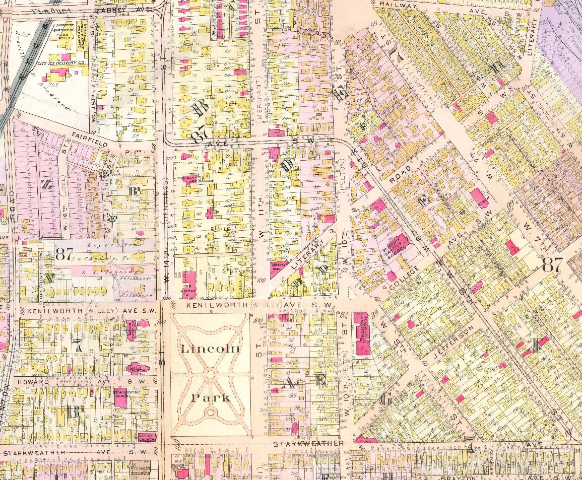
- Known as The South Side in 1912, Tremont’s population was 3-4 times larger than it is now. A major reason for the decline was the construction of Interstate 90 in the 1960s, which now runs almost directly north/south between West 14th Street and Scranton Avenue. More than 150 homes were destroyed to make room for the 2-mile stretch of freeway. Some streets, such as Wade and Vega Avenues, experienced the loss of multiple homes. And as noted in this 1912 map, some streets (and their homes) were eliminated completely, including West 15th Street south of Abbey Avenue, West 16th Street running south off Fairfield and West 16th Street between Branch and Rowley (not shown).
- As a result of freeway construction, other streets that formerly connected West 14th and Scranton now dead-end in the middle, including, Auburn Avenue, Howard Avenue, Branch Avenue and Mentor Avenue.
- Note the map’s dual references to Professor Street (West 8th Street), Tremont Street (West 9th Street) and Pelton Street (West 10th Street). Alman Court behind Pilgrim Church later became West 15th Street.
Lincoln Park and the Auburn and Lincoln Heights Neighborhoods, 1912chris1012020-04-15T14:47:47+00:00